One of the ICEREG project main outputs is a jointly developed solution for improved management of ice-jam flood risk by using corresponding flood maps and the conceptual model of ice-jam formation with respect to climate change.
This solution will help to improve the management of ice-jam flood risk in cross-border regions of Latvia and Lithuania. It consists of two parts:
- A conceptual model of the ice-jam formation;
- Ice-jam flood hazard and flood risk maps.
The Conceptual model of the ice-jam formation has been developed within the frame of the ICEREG project in the beginning of year 2025.
Ice flood hazard and risk maps with 0.5%, 1%, and 10% probability, as well as for years 2050, 2070, 2100 were developed recently based on modelling results for the pilot areas in Latvia and Lithuania.
These pilot areas are:
- Lielupe River from the junction of Memele and Musa rivers near Bauska city to the river stretch downstream the Hydrological observation station Stalgene (LV);
- Daugava River from Nereta River to the river stretch upstream Aiviekste River (LV);
- Musa River from Gustoniai to Ustukiai (LT);
- Levuo River from Pamarliskiai to Skaistgiriai (LT).
Ice-jam flood simulation was performed using 1D HEC-RAS Model and the tool “Excel-VBA” created by SYKE (FI) experts especially for the ice-jam flood modelling. Data on river ice regime from the monitoring stations operated by Latvian Environment, Geology and Meteorology Centre and Lithuanian Hydrometeorological Service for the period from 1961 to 2023 were used.
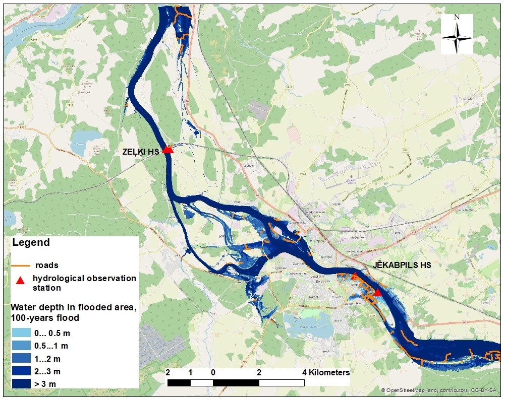
Ice flood hazard maps include information about the floods with the return periods of 200, 100, and 10 years (Fig. 1), and Lithuanian experts created an additional map of 1000–years ice flood.
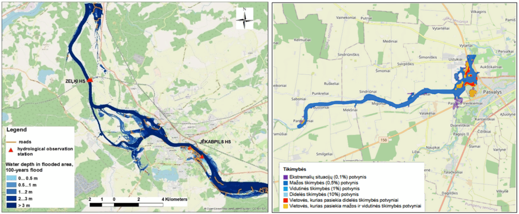
Figure 1. Maps of the ice flood on Daugava River near Jekabpils city (left) and on Musa River near Pasvalys (right)
The impact of climate change on the ice regime has been investigated in the first year of project implementation. Despite of warmer winters foreseen in the upcoming decades, ice-jam floods might still be expected. In Latvia, ice-jam flood maps have been published in accordance with the RCP 8.5 (high greenhouse gas emission scenario) for three periods: 2021-2050, 2041-2070, and 2071-2100. In Lithuania, future ice-jam floods were modelled in accordance with two scenarios, SSP2-4.5 and SSP3-7.0, for the same three periods (Fig. 2).
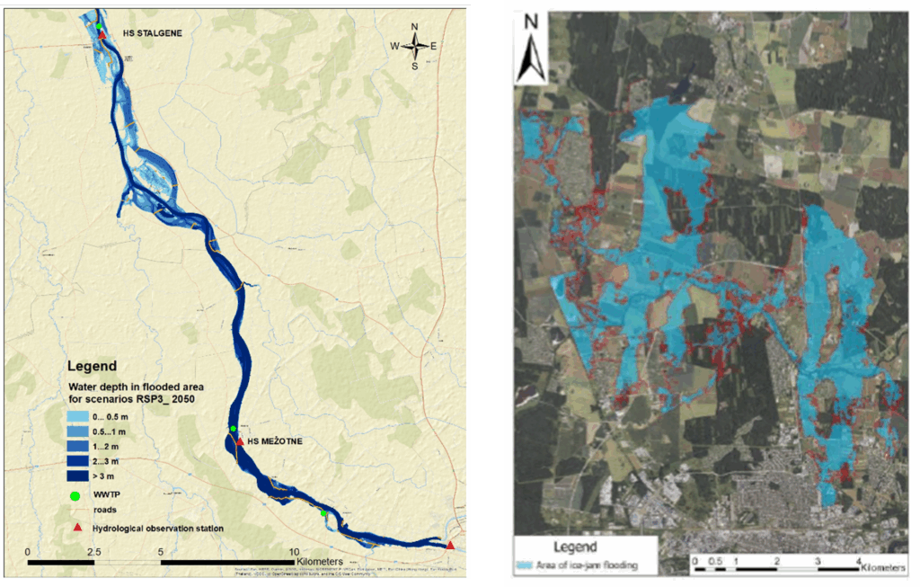
Figure 2. Maps of the ice flood on Lielupe River (left) in accordance with RCP 8.5 and on Levuo River (right) in accordance with SSP2-4.5 for the period 2021-2050
The ice-jam flood risk maps have been prepared to provide information about inhabitants, roads, WWTPs and specific objects like hospitals and schools in the flooded area.
Lielupe and Daugava rivers ice-jam flood hazard and risk maps are available on the LEGMC homepage. Musa and Levuo rivers ice-jam flood hazard and risk maps are published on the LHMS homepage.
The jointly developed Ice-jam flood maps will be integrated with the national Flood hazard and flood risk maps in the Flood Risk Information System, and relevant information will be included in River Basin Management and Flood Risk Management Plans, after discussion with all stakeholders including municipalities and Climate and Energy Ministry. Planned activities include two national Stakeholder workshops and a Project conference to introduce the developed solution and promote its use after project completion.