Send us a message
Project duration
01.03.2025 – 28.02.2027
Project ERDF co-financing
557 501,60 EUR
Geosites
LL-00244
Enhancing protection and conservation of geological structures in Latvia and Lithuania
Common territorial challenge (s) that will be tackled by the project
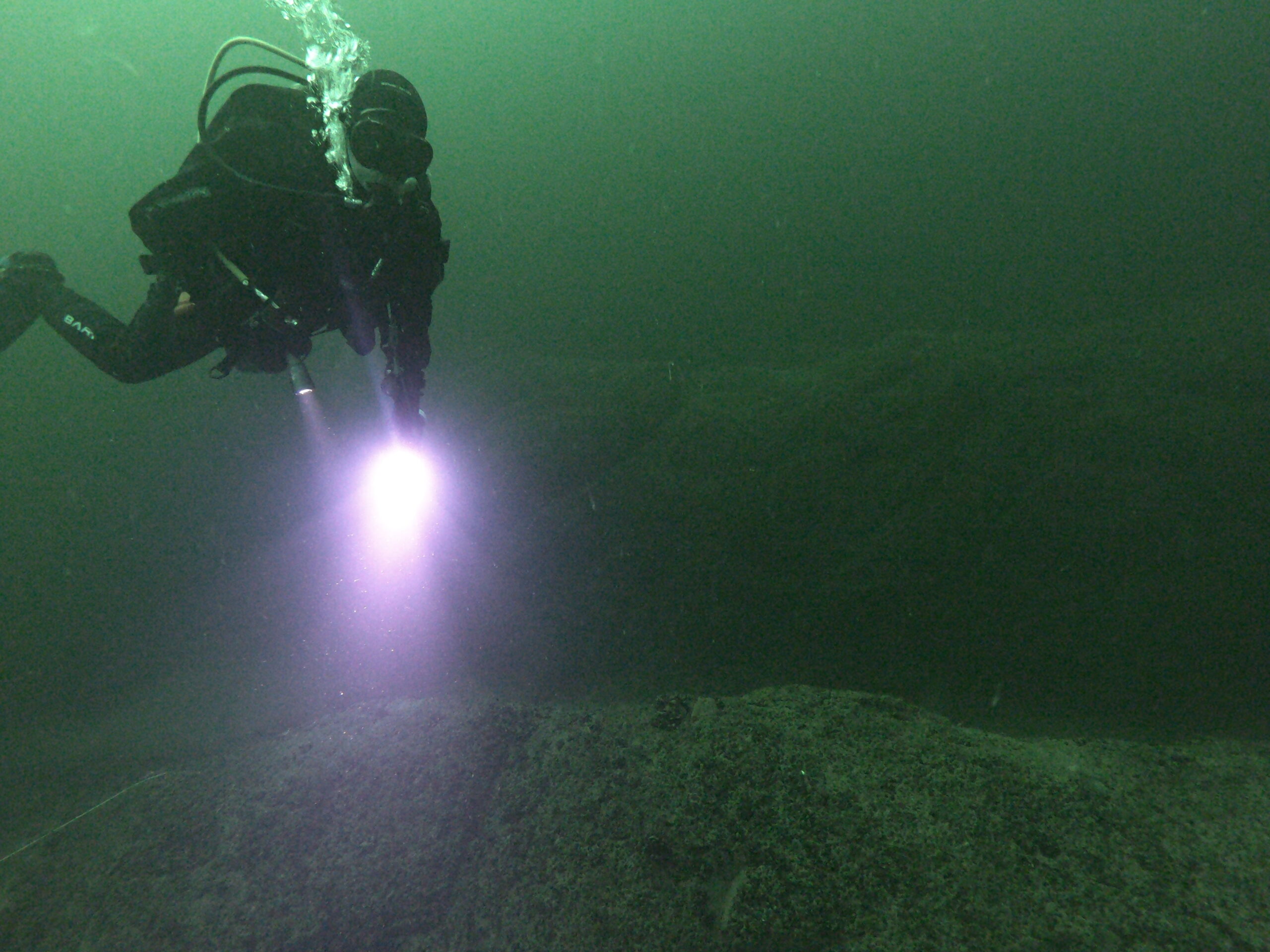
The project addresses the shared challenge of protecting and managing underwater and terrestrial geological heritage in Latvia and Lithuania. Increased human access, poor visibility, and sediment disturbance threaten the conservation of key underwater formations in Lake Plateliai and Alki Bank, while fragmented geological data in Kurzeme and Žemaitija hampers regional planning and heritage protection. The lack of integrated research and management approaches further complicates sustainable conservation. By conducting detailed underwater studies, inventorying terrestrial sites, and developing management strategies and educational tools, the project strengthens cross-border efforts to safeguard geological heritage and enhance public awareness.Project objective
The project aims to enhance the protection, management, and sustainable preservation of geological heritage in Latvia and Lithuania. This will be achieved through detailed underwater research in the Baltic Sea and Lake Plateliai, alongside a systematic inventory and assessment of terrestrial geological sites in Kurzeme and Žemaitija. By integrating geomorphological and biological research with advanced mapping technologies, the project will develop evidence-based management strategies and educational materials. Strengthening cross-border cooperation, it will provide essential data to support regional planning and ensure the long-term conservation of geological heritage.Planned activities
The project will carry out a range of activities to enhance the protection, research, and sustainable management of geological heritage in Latvia and Lithuania. Underwater mapping and research in the Baltic Sea and Lake Plateliai will investigate geomorphological formations and their ecological significance using advanced surveying technologies and diving operations, improving data accuracy and understanding of these unique environments. At the same time, terrestrial geological sites in Kurzeme and Žemaitija will be identified, documented, and assessed to determine their scientific, educational, and conservation value. Based on the collected data, detailed geological maps and models of selected sites will be developed, improving access to geological information for researchers, planners, and conservationists. Management recommendations and site-specific plans will be prepared to support the long-term preservation and sustainable use of geological heritage, ensuring evidence-based decision-making. To raise public awareness and engagement, educational materials will be produced, and targeted outreach activities will be organised, involving schools, local communities, and tourism stakeholders. These efforts will highlight the significance of geological heritage and promote responsible exploration and conservation. Strengthening cross-border cooperation will be a key aspect of the project, with joint fieldwork, knowledge exchange, and workshops facilitating a coordinated approach between Latvia and Lithuania. The project’s final results, including research findings, management tools, and educational resources, will be presented at a closing event, engaging key stakeholders such as authorities, researchers, and the wider public. By ensuring broad dissemination and practical application of the project’s outcomes, this initiative will contribute to the long-term protection and sustainable management of geological heritage in the region.Social media and contacts:
Phone: +371 67601995
E-mail: hydro@latnet.lv
Website: https://lhei.lv/
Address: Voleru iela 4, Riga, LV-1007
-
November 1, 2025 - November 1, 2025
Geoday at Pūsēnu HillNīcas pagasts Kaires ciems, Latvia